
Track the Coral Gables Trolley live
Track Coral Gables trolley arrival times in one app. Get live ETAs, every route, stop lookups, maps, and favorites for iPhone and Android.


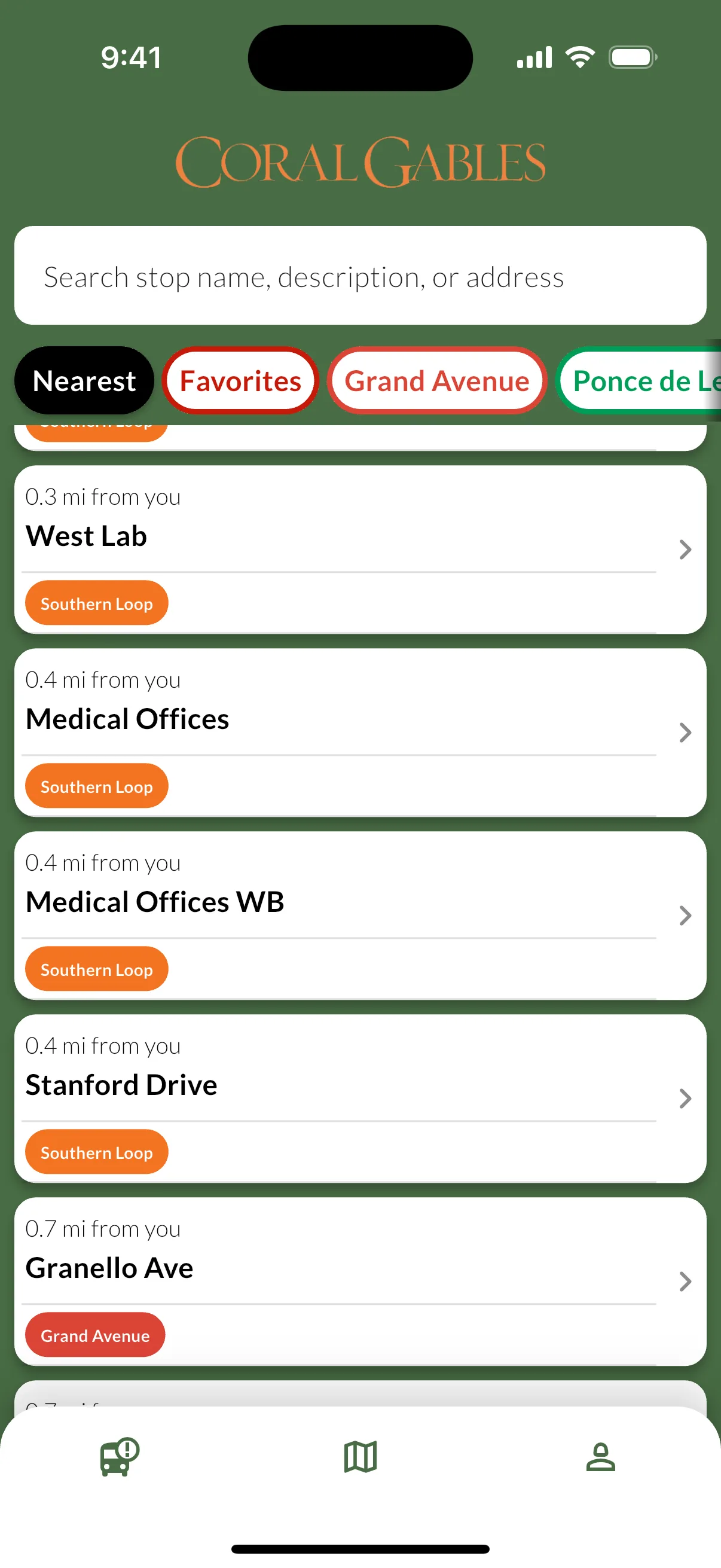
Everything you need for the Coral Gables trolley
Check live ETAs, route details, stop information, and maps for every Coral Gables route whether you ride every day or just need a quick connection.
Live Arrival Times
See when your trolley is actually arriving, not just the printed schedule. Live ETAs update throughout the day when live data is available.
Every Route Covered
Browse Ponce de Leon, Grand Avenue, and Southern Loop in one app, with stop-by-stop detail for each.
Routes, Stops & Maps
Browse each route, open stop details, and jump into the map to understand exactly where to board.
Favorites for Daily Trips
Save your regular stops so you can get back to the arrivals you care about without starting over each time.
Free to Ride. Free to Use.
No sign-up, no account, and no fees. The service is free to ride, and the app is free to use.
Available in Spanish
Use the app in English or Spanish, whichever you prefer.
See how the app works
From nearby stops and live arrival times to route maps and favorites, here is what Coral Gables Trolley Tracker looks like in use.
Nearby Stops
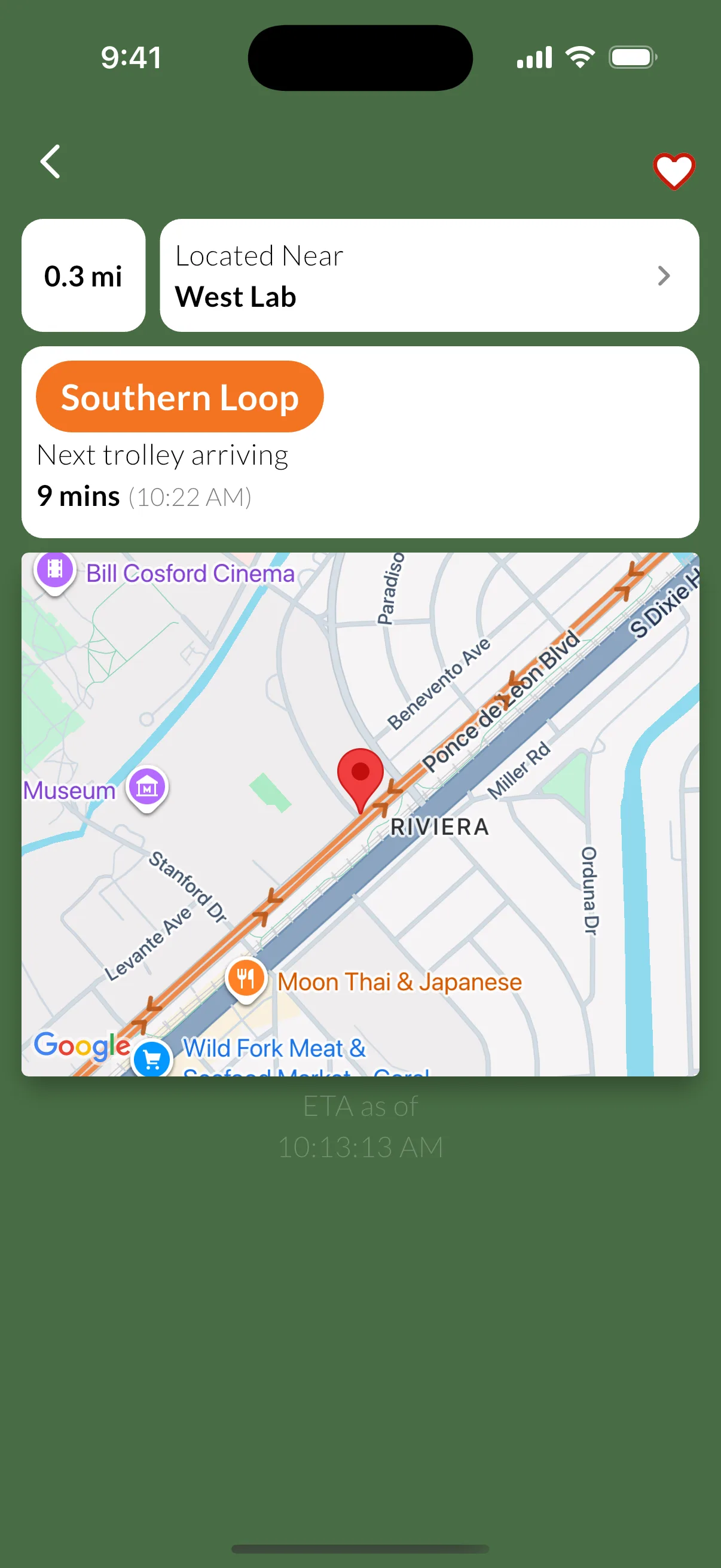
Live arrival times that make connections easier
See when the next Coral Gables trolley is expected at your stop. Each arrival shows whether the time is a live GPS-based ETA or a scheduled estimate - especially handy when you are timing the Douglas Road Metrorail connection.
Live ETAs
GPS-based arrival times when live data is available
Multiple routes per stop
See every route serving your stop in one place
Embedded map
Open the map to see exactly where your stop is located
Navigate in Maps
Open any stop directly in Apple Maps or Google Maps.
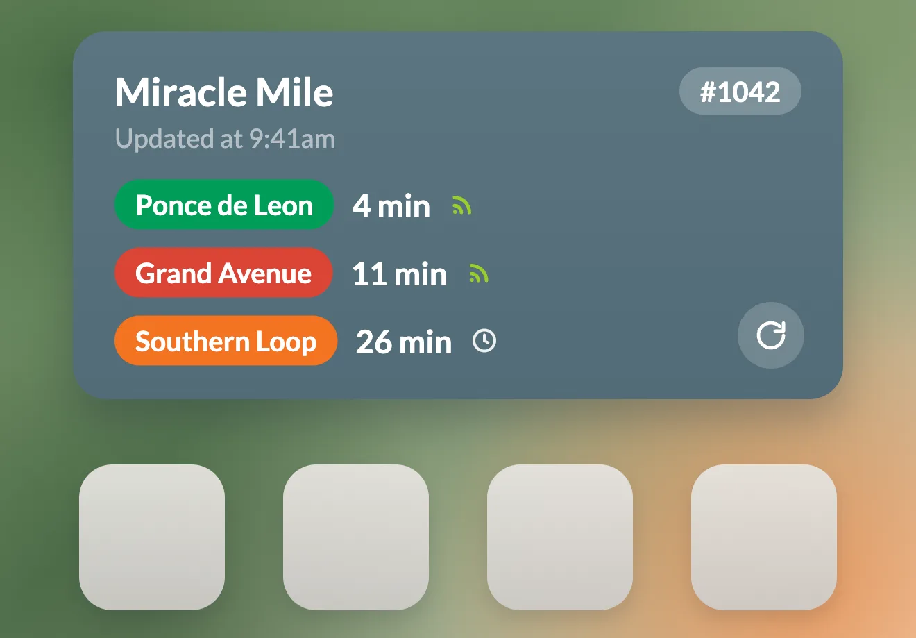
Home Screen widgets are coming soon
Coral Gables Trolley Tracker will support Home Screen widgets in a future update. For now, use the app for fast stop lookup, live arrivals, maps, and favorites.
Quick stop access
Pin your favorite stop details to the Home Screen as soon as widget support launches.
Live arrivals at a glance
The widget experience is planned to surface the next trolley without opening the app first.
Disponible en español
Si prefieres usar Coral Gables Trolley Tracker en español, abre la versión en español del sitio.
Made for daily rides and quick connections
Whether you commute into downtown Coral Gables, shop along Miracle Mile, or connect to the Metrorail, the app helps you spend less time waiting and more time moving.
New to the Coral Gables routes?
The Coral Gables trolley is easy to use once you know which route serves your area. The app helps you compare routes, stops, and arrivals before you head out.
- Find the closest stop near Miracle Mile, the Douglas Road Metrorail station, or the Village of Merrick Park
- See which route gets you closer to your destination
- Use the map to understand where each stop is before you walk over
Ride regularly?
Skip the uncertainty of waiting at the curb. Save your routine stops, check ETAs before you leave, and pull up the route map when you need to make a fast decision.
- Save your daily stops to Favorites for faster access
- Check route and stop details before you head out
- Filter arrivals by route to focus on the trolley you need
Every Coral Gables route in one app
Track every current Coral Gables trolley route in one place, from Ponce de Leon, Grand Avenue, and more, with arrivals, stop details, maps, and favorites.
Follow the Ponce de Leon route along the city's main corridor, with live arrivals before you walk to the stop.
Track Grand Avenue stops and arrivals when you are moving between neighborhood destinations and nearby connections.
Check the Southern Loop, the newest route extending service from the Douglas Road Metrorail station toward Red Road via Ponce de Leon Blvd.
Looking for the separate City of Miami trolley system instead? Use Miami City Trolley Tracker .
Frequently asked questions
Common questions about Coral Gables Trolley Tracker and the Coral Gables trolley service.

Stop guessing. Start tracking.
Download Coral Gables Trolley Tracker for free and know when your next trolley is due. Available for iPhone and Android.
Free to download. No account required.